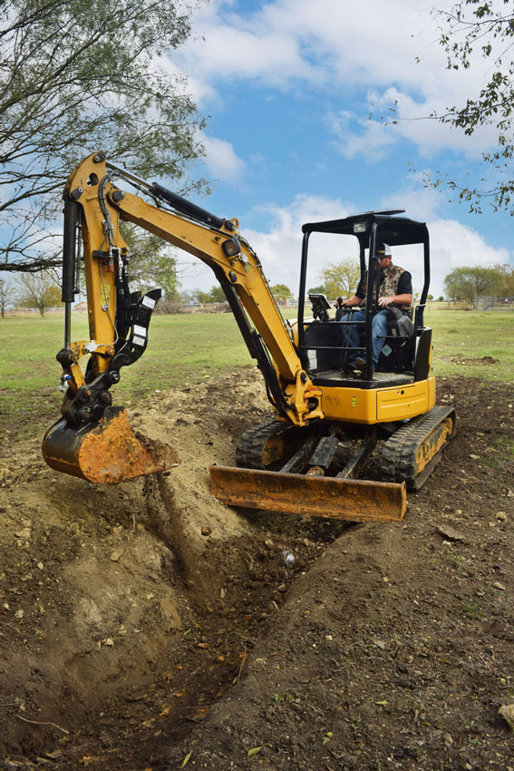
Excavator 3D Solutions
Precision & Reliability at an Affordable Price
GradeMetrix Excavator Grade Control Systems
GradeMetrix Excavator is packed with industry leading technology. It is easy to use and delivered at an affordable price. The system can be installed and calibrated in less than 8 hours.
The GradeMetrix system is designed to fit seamlessly into your existing site infrastructure using all the same design file formats and base station corrections. To ensure your peace of mind, all major components are covered by our best-in-class 3-year warranty.
New and experienced operators can dramatically increase accuracy, efficiency, and dependability with GradeMetrix, resulting in significant ROI in your operations right away.
GradeMetrix Key Features
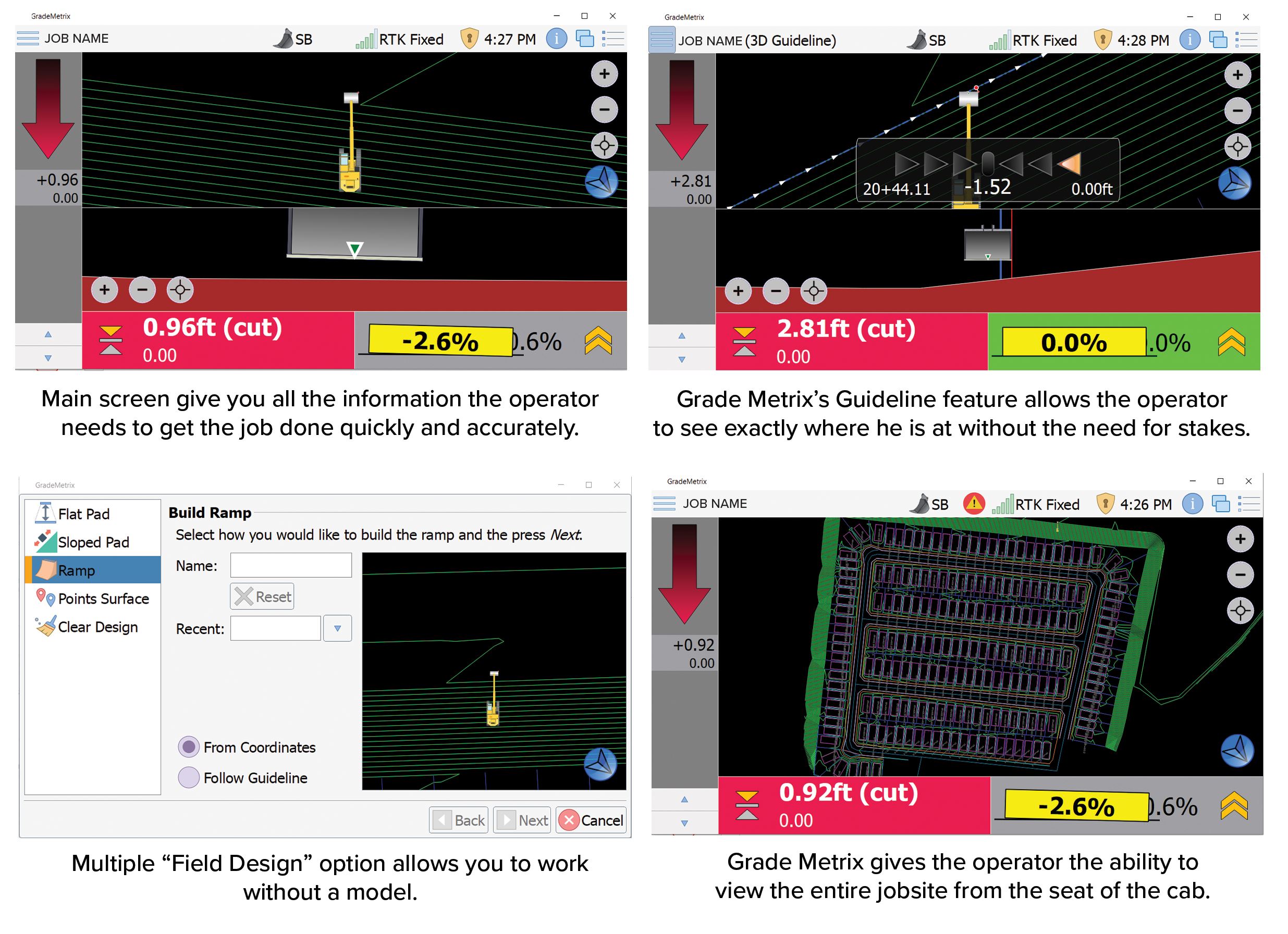
Dynamic cut/fill indication to center or either side of the bucket to allow operators to know the exact location and depth of trenches without the time and cost of expensive grade-checkers and survey professionals.
2D, 2.5D, 3D operation modes all standard. Operators can create trenches, slopes and layers to match existing or a required height, and create all on site from the cab within seconds.
Access to all GNSS satellite constellations for maximum accuracy and maximum coverage in difficult environments; including GPS, GNSS, GLONASS, BeiDou, Galileo, and QZSS.
Supports tilt bucket and laser receiver as standard.
Simplified user interface with multiple views including plan view, profile view, cross-section view, and more.
Supports industry standard file formats including: dwg, dxf, LandXML.
Easily locate lines and points yourself, checking work depths as you go.
Map projections or localized coordinate systems allow simple site coordination to existing coordinate systems or creation at new sites.
Operators visualize the site in real time, eliminating delays and enabling fast, efficient completion of all sitework.
Introducing 2.50 Grade Control
The embedded 2.5D function in GradeMetrix allows you to use the GNSS Guidance Technology for a vast array of simple and useful applications without the need for complex 3D files from a land surveyor.
Using only a few keystrokes, you can easily create simple layers, single or dual slopes, ramps, and even roads: using your GNSS as a reference. Also, using the optional Futtura F631 base station, you can provide your own RTK corrections to your excavator.
In addition to the 3D model benefits, the 2.5D functionality will significantly speed up your work cycles and dramatically reduce your ROI time.
Ruggedized Hardware
Futtura’s GradeMetrix Excavator solution is powered by hardware components that have undergone extensive shock, vibration, and environmental testing to withstand the harshest job site conditions.
The system is designed in a unique format centered around the FR1000 GNSS RTK receiver. The FR1000, with its integrated UHF radio and GNSS receiver requires single cable connection to the FMD-1 display resulting a in the most simplified installation and calibration procedure on the market, and is the result of multiple decades of experience merging GNSS technology with precision applications.
All the GradeMetrix system key components are covered by an industry leading 3-year warranty. You can have peace of mind and confidence that your GradeMetrix Excavator solution will provide superior results and performance for the long term.

Your Benefits At A Glance
Fewer passes - Get to grade faster
Less rework
Use less material - Reduced transportation costs
Do your own stake out - Less grade checking - Less stake replacement
Less personnel around machines -Operator stays in machine
Primary components can be moved easily and quickly between machines
Best in class warranty
Lower initial investment - Faster return on investment
Performance - Simplicity - Value
Excavator Solutions
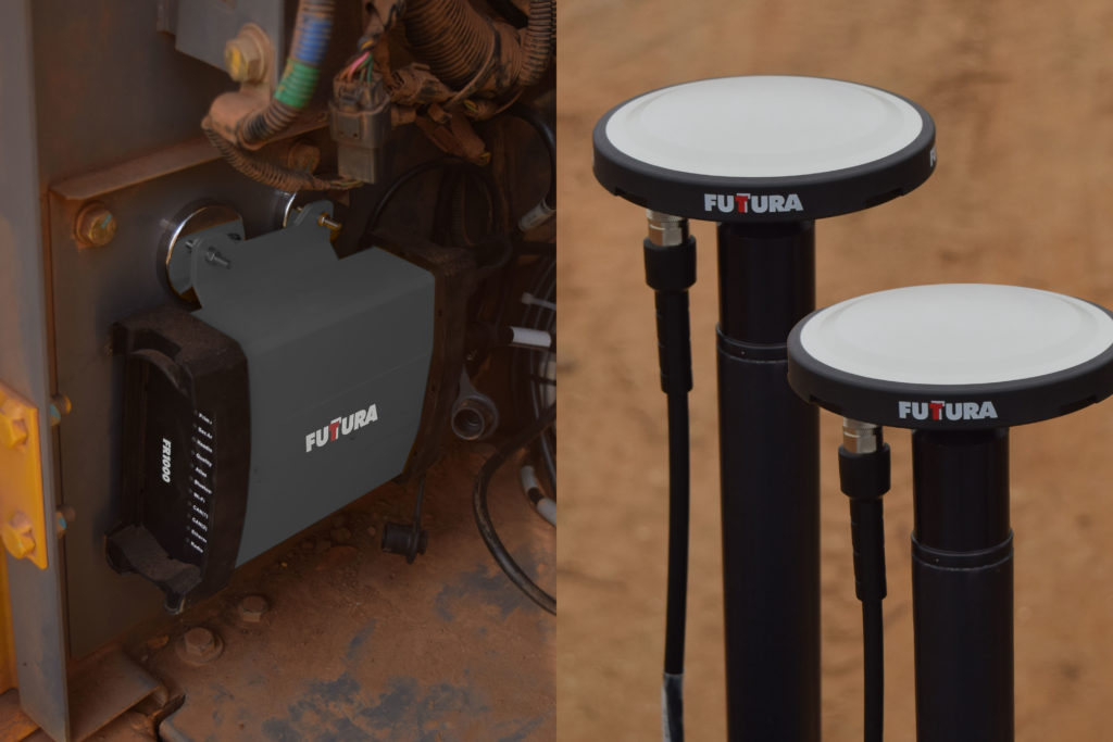
FR1000 GNSS Receiver
• Multi-frequency, Multi-GNSS GPS/ GLONASS/BeiDou/Galileo/QZSS capable
• Integrated 400 MHz UHF Radio
• Powerful WebUI with ethernet, CAN, serial, Bluetooth and Wi-Fi connections
• IP69K and MIL-STD-810G
, Rugged GNSS antenna array

FR5OO GNSS RTK Smart Antenna
• Dual RTK Smart Antenna for compact excavator• Multi-frequency, Multi-GNSS GPS/ GLONASS/ BeiDou/Galileo/QZSS capable
• Integrated 400 MHz UHF radio
• Powerful WebUI, ethernet, CAN, serial, Bluetooth and Wi-Fi
• IP69K and MIL-STD-810G
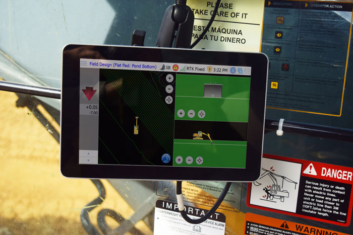
FMD-1 Rugged Machine Display
• High-resolution screen
• Powerful CPU for embedded applications
• Supports Linux and Windows OS options
• Connectivity with integrated cell modem